A proposal to build 52 homes at a site off Westbrook Road in Lincoln has been met with over 70 written objections, including concerns about flooding provisions.
The plans are set go before the City of Lincoln Council’s planning committee on Wednesday, December 10.
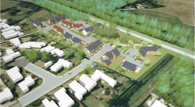
The site is located between existing residential development on Westbrooke Road and Tritton Road. It is privately owned and is principally unmanaged grassland with a few wooded areas.
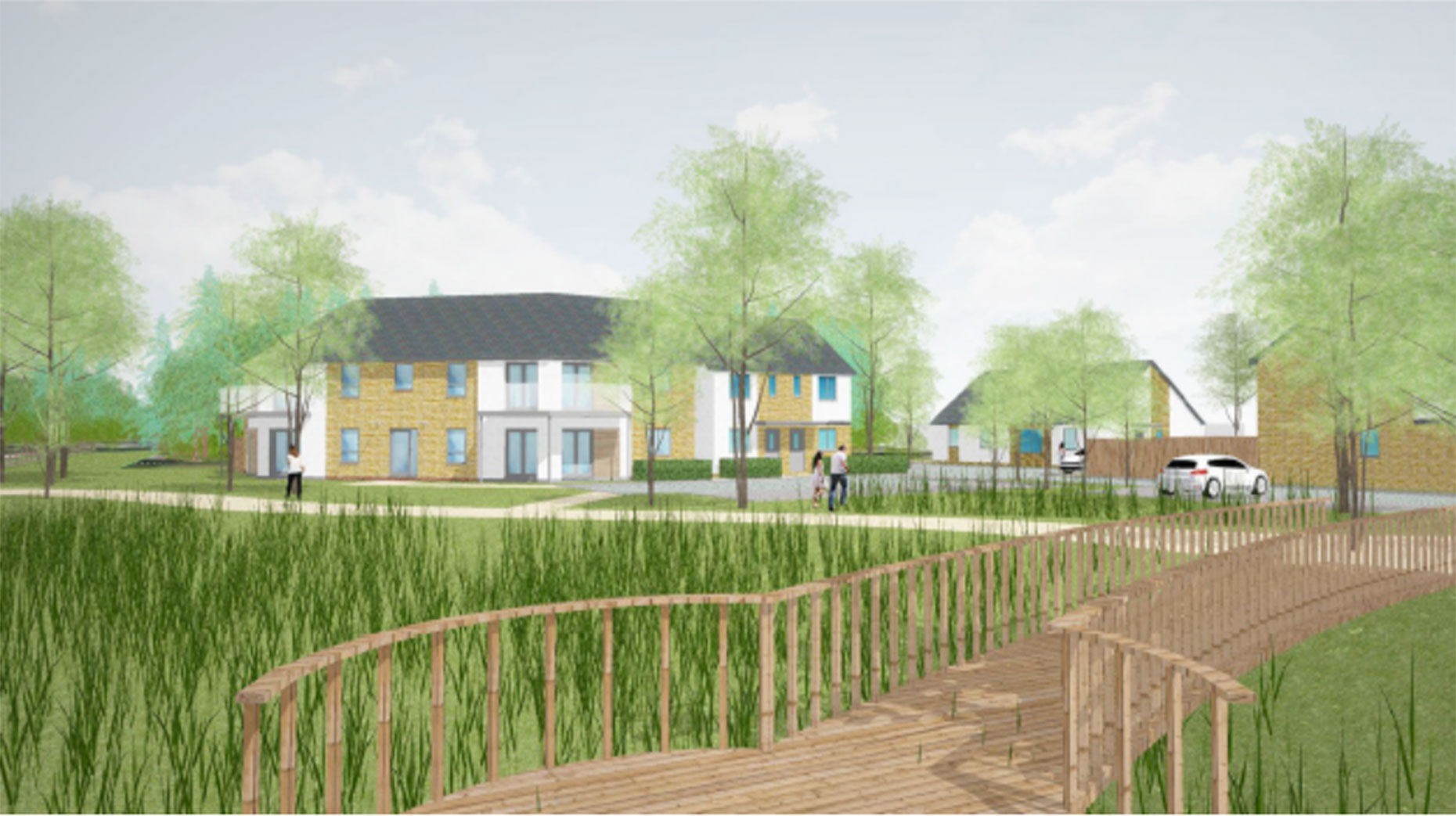
An overview of the proposed development.
Having originally been submitted as a 60-home plan, applicant Chestnut Homes’ proposals for the 1.53 hectare site raised concerns as the the appropriate scale of an apartment block, drainage/flooding of the site and the number of parking spaces and highway matters.
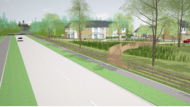
View of the planned development from the road.
The proposal was therefore revised to 52 dwellings, a reduction in size and scale of the apartment block to a two storey form, re-positioned parking provision and the introduction of a filter drain.
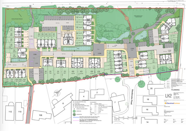
The site, which qualifies for an affordable housing contribution, will include 11 affordable dwellings .
Outline plan for the development
The applicant also proposed a bus stop on Tritton Road adjacent to the site. This has been declined by the Highway Authority due to the unsuitability of the location.
The Central Lincolnshire Five Year Land Supply Report 1 April 2015 to March 2020 identifies a shortfall in the city’s five year supply of sites of 1,872.
The report states: “Without a five year land supply, it makes it harder for councils to refuse a planning application, because we are not able to meet our housing need.”
The scheme is recommended for approval with the conditions of a 3-year time-frame and detailed landscaping and drainage schemes.
Flood risk
The site is in flood zone 2 and is adjacent to the Catchwater Drain. Some localised flooding has occurred in the Westbrooke Road area in recent years, as identified in many of the objection letters received from local residents.
Further information and mitigation measures have however been incorporated into the plan and concerns initially raised by both the Environment Agency and the Upper Witham Internal Drainage Board have been withdrawn.
The proposal has been revised to provide a sustainable drainage system (SUDs) with on site swales and attenuation pond.
The ground will need to be raised on the development site as a flood risk mitigation measure and drainage solution.
The finished floor levels will on average be increase by 1m, and the impact of residential amenities has also been raised in objections.
The Lincolnite welcomes your views. All comments are reactively-moderated and must obey the house rules. Please stay on topic and be respectful of other readers.
Exciting news for MyLocal app users and The Lincolnite readers! Our latest update is now available to download from your app store and comes packed with the best local news experience you can enjoy.
Revamped News Feed: Enjoy faster loading times and smoother scrolling that make catching up on local news a breeze.
New Play Video Feed: Dive into a dynamic video feed that brings local stories to life in a whole new way.
Enhanced In-App Browser: Access external links quickly and efficiently, right from the app, without any distractions.
Update your MyLocal app from your app store (version 2.73) now and start enjoying these great new features today!
P.S.: Start your MyLocal membership today to support MyLocal and The Lincolnite deliver you a better local news experience and honest journalism from across Lincolnshire.
P.P.S.: We have some huge things in the pipeline, stay tuned!
 Whatsapp