January 8, 2016 7.10 am This story is over 97 months old

Flood alert issued for River Trent west of Lincoln

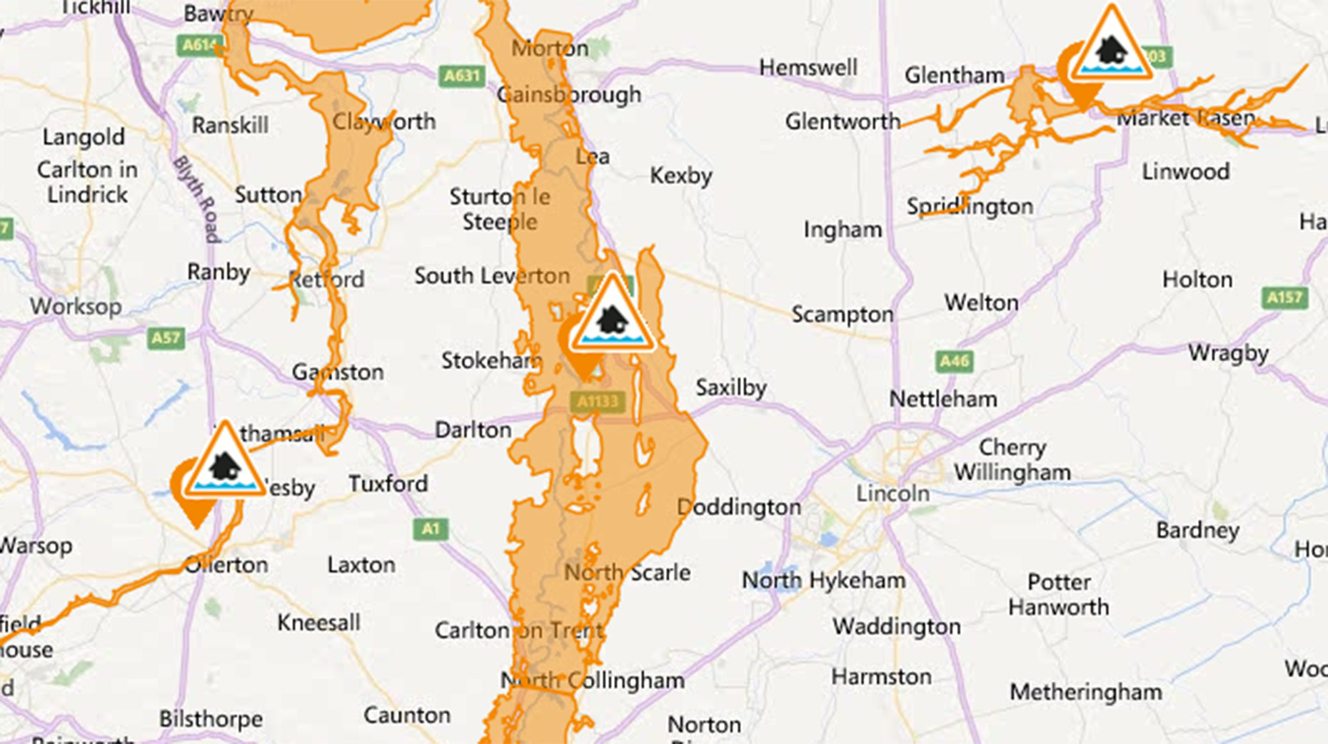
Flood alert: A flood alert has been issued by the Environment Agency for villages, agricultural land and roads to the west of Lincoln over the next 24 hours.

A flood alert has been issued by the Environment Agency for villages, agricultural land and roads to the west of Lincoln over the next 24 hours.


Update, January 8 6.30am: The flooding alert is once again in force from 8.15am on Friday, January 8.

The latest information warns: “Flooding of low-lying agricultural land and roads continues.

“The current level at the Torksey river gauge is 4.7 metres. River levels are rising, and are expected to be 4.9 metres at 9.00pm this evening.

“Light rainfall is forecast over the next 12 hours, with totals of around 5 milimetres expected”


The patch highlighted as being at risk of potential flooding concerns the River Trent, and stretches from Cromwell Weir to Gainsborough.

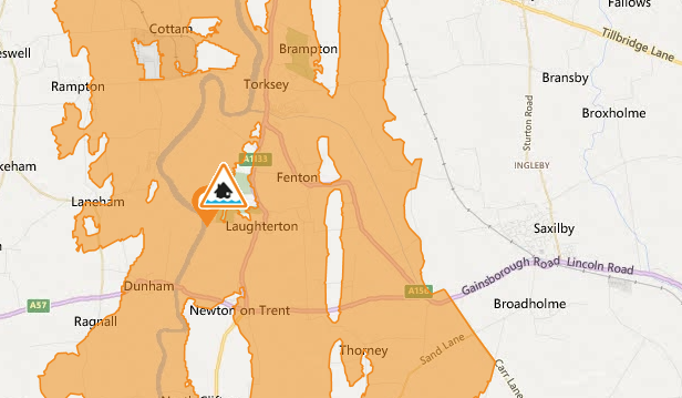
The warning area also swells to include areas east of the river such as Lincoln villages Saxilby, Torksey and Doddington.

Flood alert issued by the Environment Agency.

Flood alert issued by the Environment Agency.

In force from 10.41am on Thursday, January 7, the alert refers rising water levels at the Torksey station.

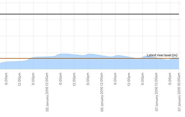
Water levels predicted by the Environment Agency a Torksey (Flooding possible over 4.65m)

Water levels predicted by the Environment Agency a Torksey (Flooding possible over 4.65m)

The alert reads: “The Flooding of low-lying agricultural land and roads continues. Church Laneham to Rampton Road may be affected by flood water.

“The current level at the Torksey river gauge is 4.7 metres. River levels are steady, and are expected to be between 4.8 and 5 metres at 9.00am tomorrow.

“Further light rainfall is forecast over the next 24 hours, with totals of around 5 milimetres expected.”

River Witham rising

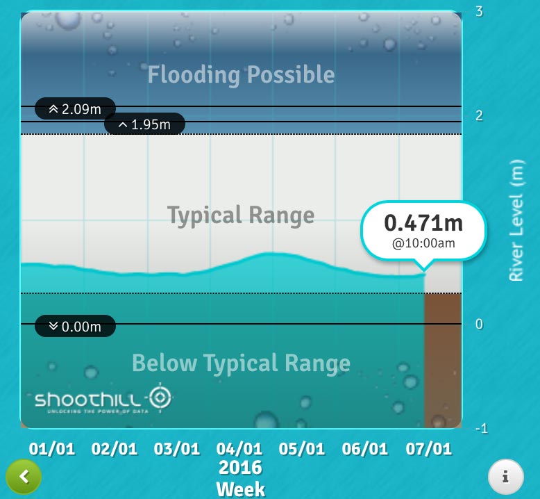
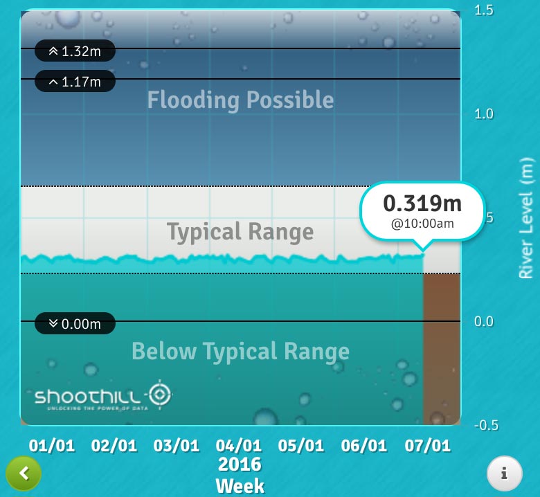
Levels within Lincoln, surrounding the River Witham, are currently below the level where possible flooding may occur.

Levels in the Stamp End area are rising, and motorists are being warned to be aware of standing water on roads across the county.

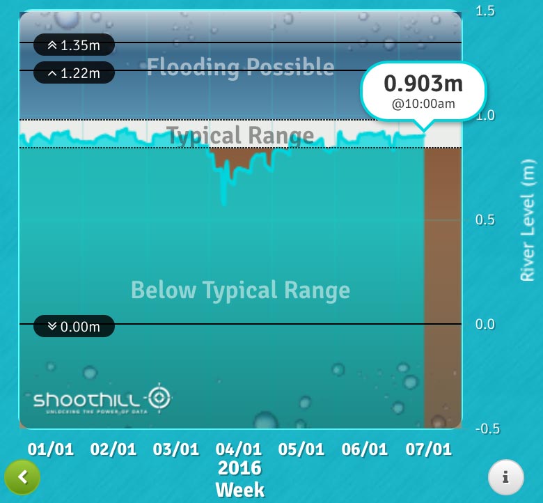
The water level at Stamp End

The water level at Stamp End

The water level at Bracebridge

The water level at Bracebridge

The water level at Brayford Pool

The water level at Brayford Pool

You can see live flood updates from the Environment Agency here.