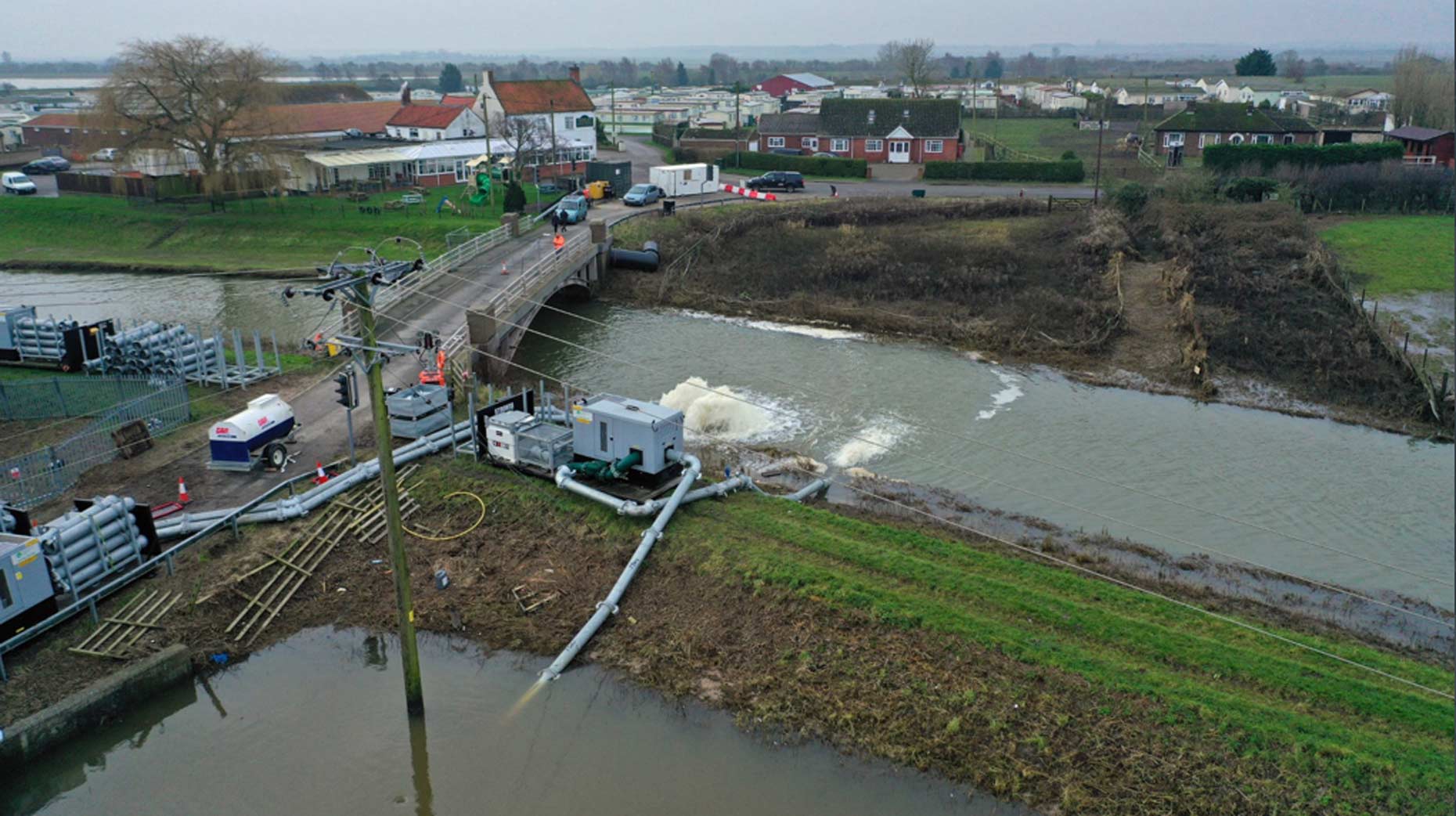
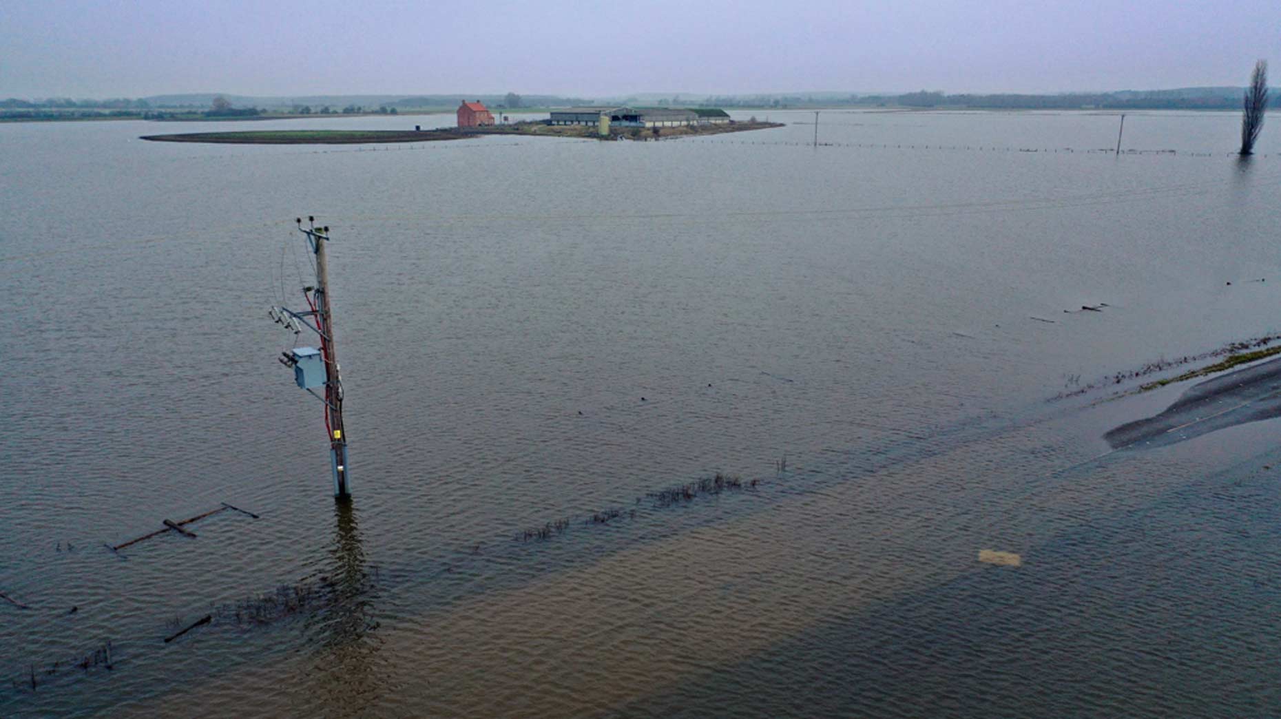
An investigation will begin today after farmers near Lincoln were left stranded by flooding into land around Short Ferry.
As previously reported, over 1,000 acres appeared to still be underwater last month and a road closure was in place after the Barlings Eau was breached. The Barlings Eau, five miles east of Lincoln, flooded into land around Short Ferry after the bank collapsed on November 9.
Lincolnshire County Council’s highways team will be assessing the structural condition of the road before it can be re-opened to traffic. The highways team is planning to carry out an investigation on Thursday, January 2.
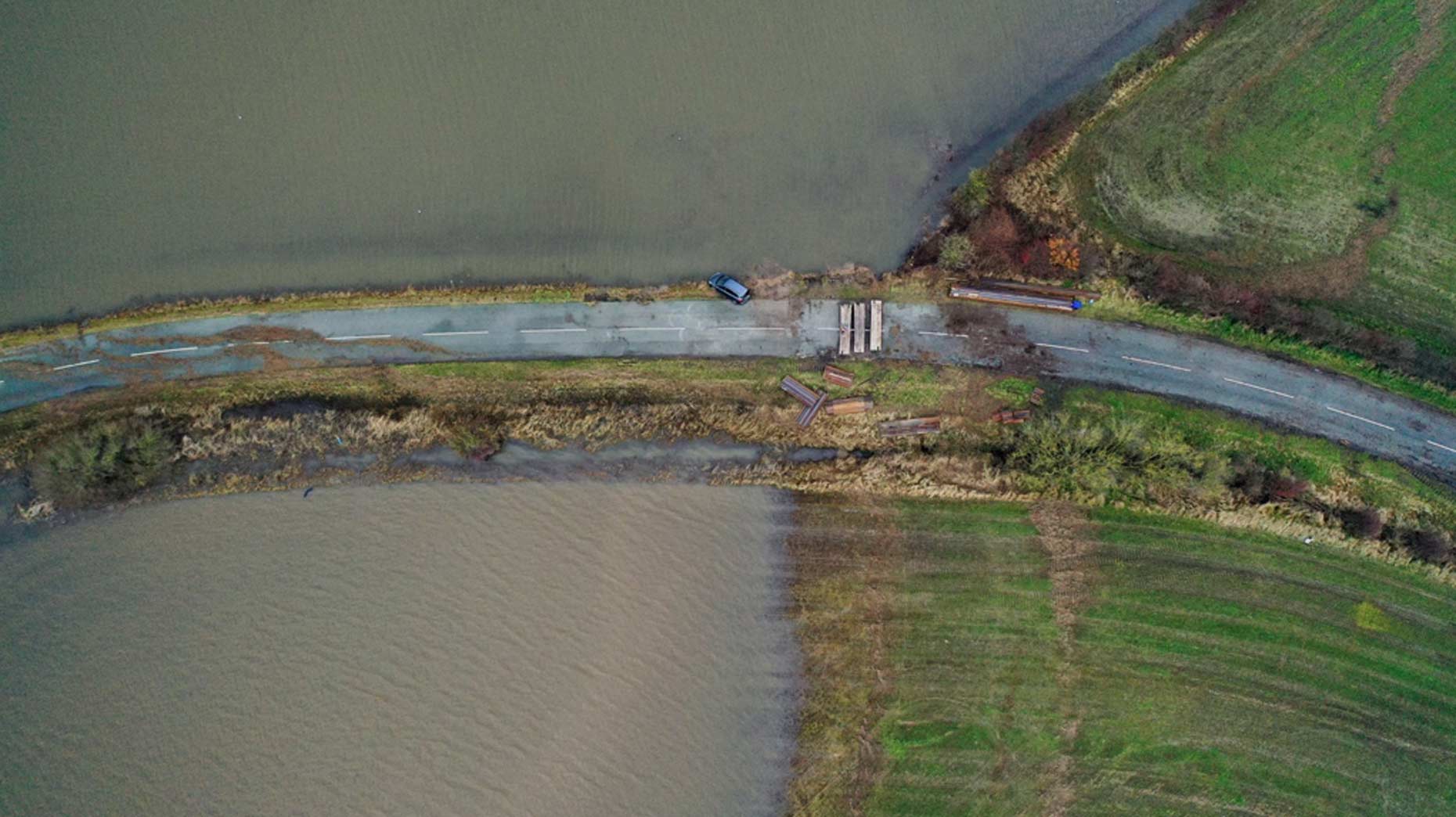
Photo: Kurnia Aerial Photography
Farmers were left stranded, including Henry Ward who owns a farm east of the city which was flooded in up to six feet of water.
The Environment Agency completed repair work on the Barlings Eau which involved using a floating pontoon. Pumps also shifted around 48 Olympic-sized swimming pools worth of water off the land every day.
The flood water began to clear just before Christmas and the surface of the road is again becoming visible. Kurnia Aerial Photography filmed footage of the latest situation on December 29, 2019.
Short Ferry flood update – 29/12/19 week 7 – The water is gradually going down & the road now visible. Great to see local volunteers collecting a mountain of rubbish that has appeared.
Karen Cassar, assistant director for highways at Lincolnshire County Council, previously said: “Given the amount of time the road has been underwater, there is a good chance it has suffered significant damage.
“Our main concern is that the flood water may have weakened or washed away the lower layers of the road, meaning the surface could be liable to collapse under the weight of traffic.
Photo: Kurnia Aerial Photography
“So in early January we’ll be using specialist equipment to test those lower layers and determine the structural condition of the road. We’ll also be cleaning out the gullies, which will undoubtedly have been silted up by the flood water
“Once the tests have been completed, we’ll have a better idea of what repairs may be needed and a projected timetable for the re-opening of the road.”
The Lincolnite welcomes your views. All comments are reactively-moderated and must obey the house rules. Please stay on topic and be respectful of other readers.
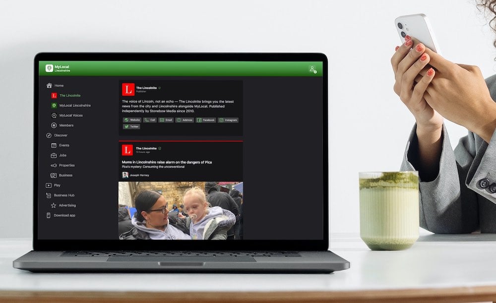
Exciting news for MyLocal app users and The Lincolnite readers! Our latest update is now available to download from your app store and comes packed with the best local news experience you can enjoy.
Revamped News Feed: Enjoy faster loading times and smoother scrolling that make catching up on local news a breeze.
New Play Video Feed: Dive into a dynamic video feed that brings local stories to life in a whole new way.
Enhanced In-App Browser: Access external links quickly and efficiently, right from the app, without any distractions.
Update your MyLocal app from your app store (version 2.73) now and start enjoying these great new features today!
P.S.: Start your MyLocal membership today to support MyLocal and The Lincolnite deliver you a better local news experience and honest journalism from across Lincolnshire.
P.P.S.: We have some huge things in the pipeline, stay tuned!
 Whatsapp