New photos show the extent of flooding on land where the City of Lincoln Council plans to build the Western Growth Corridor.
The plans for a new shopping centre, 3,200 homes, primary school and leisure facilities will be decided at an extraordinary full council meeting sitting as the planning committee next Wednesday.
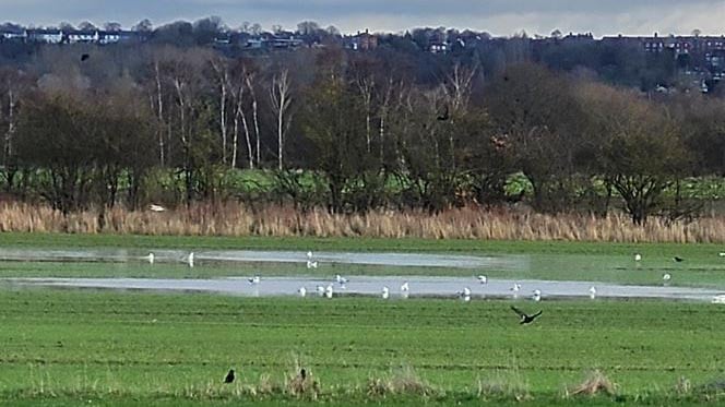
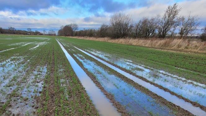
Neighbouring resident Richard Morrant has emailed councillors a series of photographs taken last week which show fields next to the Catchwater alongside Grosvenor Avenue flooded.
“This is not an ‘unexpected event’, there have been no severe weather conditions, but these fields flood just like this three to four times a year,” he said, adding they were still flooded at the time of his email.
“Obviously, along with almost every other Lincoln resident who knows this area, we just can’t understand why with so much more land now available through the new ring road extension you seem to be pushing what must be a very high-risk development?”
The Western Growth Corridor, set to the north of Skellingthorpe Road, is one of Lincoln’s four Sustainable Urban Extensions (SUEs) to allow the Central Lincolnshire area to provide for both housing and employment growth until 2036.
Wildlife is attracted to the waters. | Image: Richard Morrant
The full proposals include:
Up to 3200 homes, with a local centre comprising of retail and commercial units and a new primary school
A commercial employment area of up to 20 hectares
A regional sport and leisure complex, including a new stadium, health and leisure facilities, a hotel and ancillary food and drink elements
A report before councillors next week acknowledges the site covers a number of high risk flood zones alongside lower risk ones.
It says part of the site is subject to a flood risk in excess of one in 100 years, with risks including tidal, rivers and extreme rainfall, as well as flooding from the breach of flood defences and reservoirs.
However, it said mitigation measures would be in place to tackle the concerns.
Tracks through the fields are waterlogged. | Image: Richard Morrant
Measures include a network of Sustainable Drainage Systems (SuDS), allowing water to be stored and allowed to infiltrate back into the ground, alongside a network of swales – channels designed to catch and direct water into existing networks.
Those networks would also be widened to provide additional space, while green corridors will be created to protect potential flood flow routes.
The housing would be build on raised platforms to ensure it sits above the maximum flood water levels, while ground levels in the northern part of the site would be lowered to create additional wetlands.
A drain at the site sits higher in the ground. | Image: Richard Morrant
The plans have the support of the Environment Agency and Anglian Water has said it has capacity to accommodate the discharge from the development – though is working with the council to identify upgrades and further investment.
“A significant amount of technical work has been carried out,” said the document.
“The Local Planning Authority are given confidence by this support that the development would have no adverse impacts on existing residents and that technical matters have either been dealt with or are capable of being dealt with by condition.”
The Lincolnite welcomes your views. All comments are reactively-moderated and must obey the house rules. Please stay on topic and be respectful of other readers.
Exciting news for MyLocal app users and The Lincolnite readers! Our latest update is now available to download from your app store and comes packed with the best local news experience you can enjoy.
Revamped News Feed: Enjoy faster loading times and smoother scrolling that make catching up on local news a breeze.
New Play Video Feed: Dive into a dynamic video feed that brings local stories to life in a whole new way.
Enhanced In-App Browser: Access external links quickly and efficiently, right from the app, without any distractions.
Update your MyLocal app from your app store (version 2.73) now and start enjoying these great new features today!
P.S.: Start your MyLocal membership today to support MyLocal and The Lincolnite deliver you a better local news experience and honest journalism from across Lincolnshire.
P.P.S.: We have some huge things in the pipeline, stay tuned!

 Whatsapp