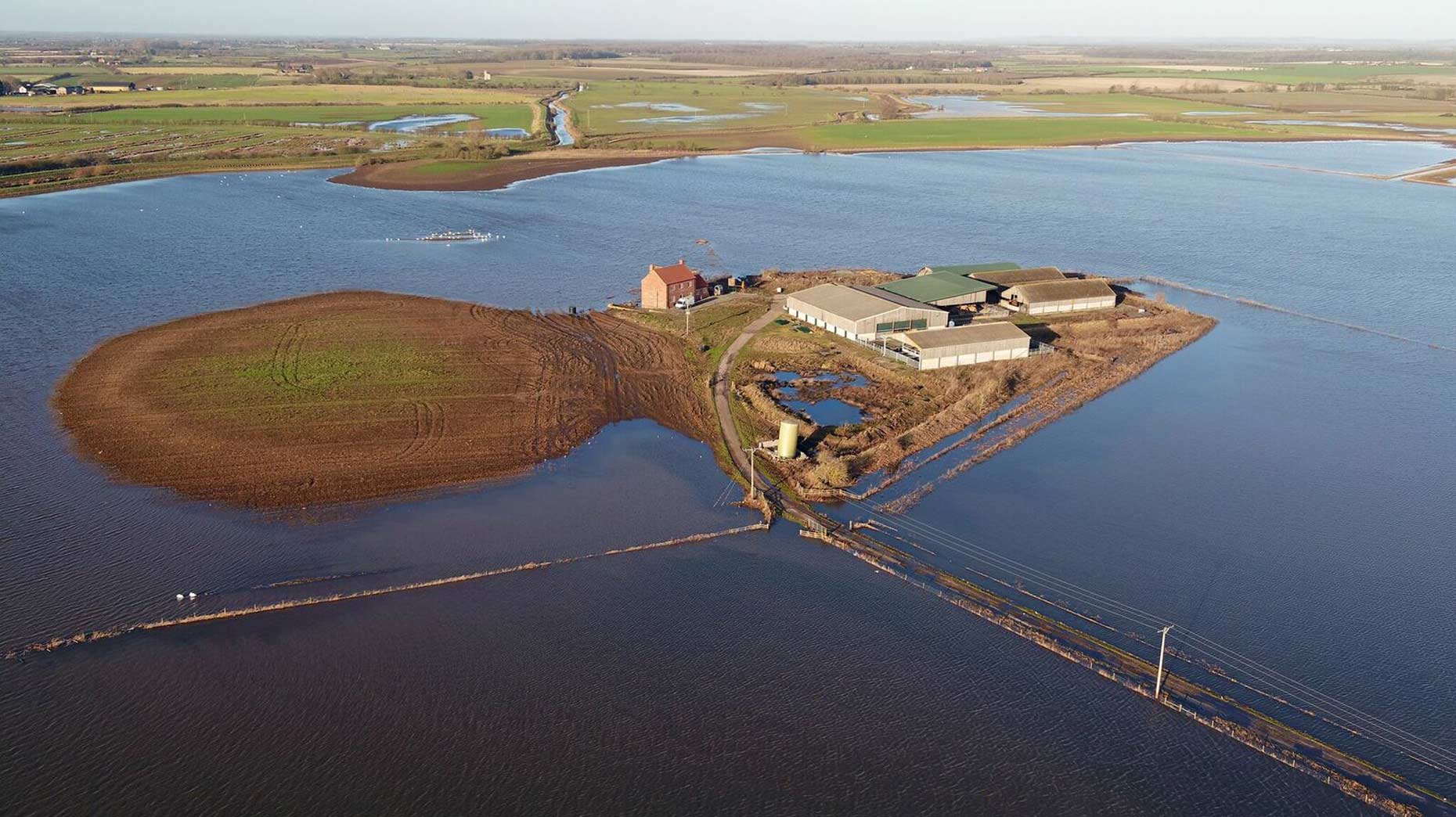
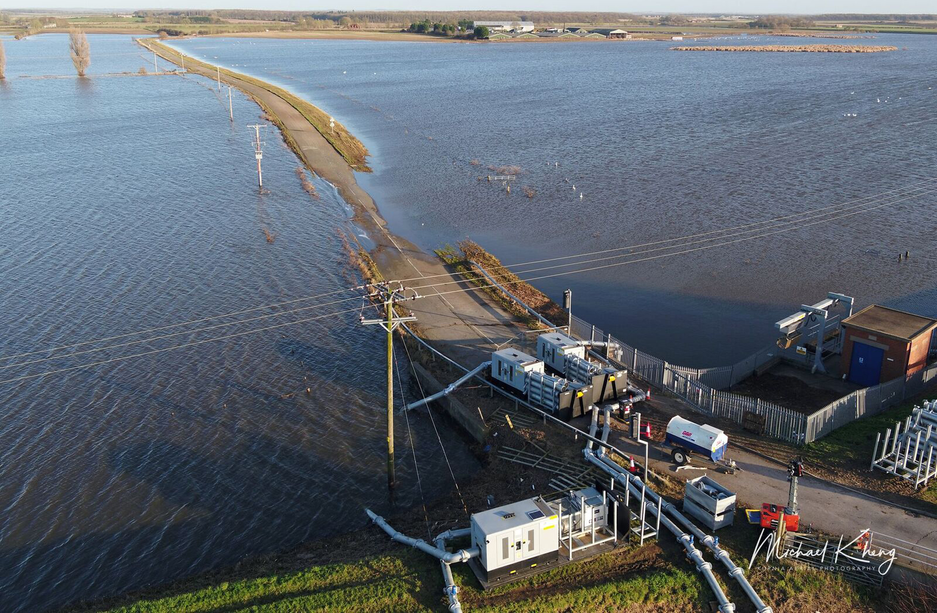
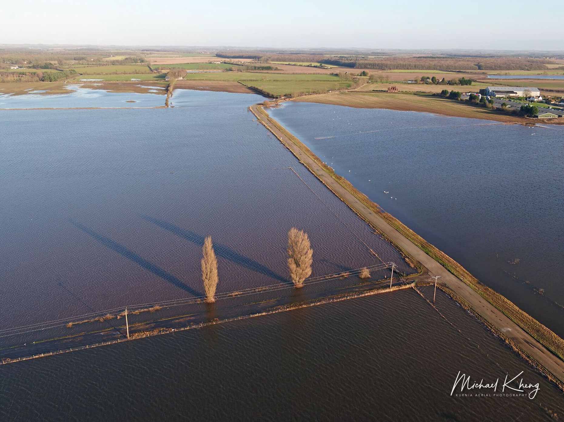
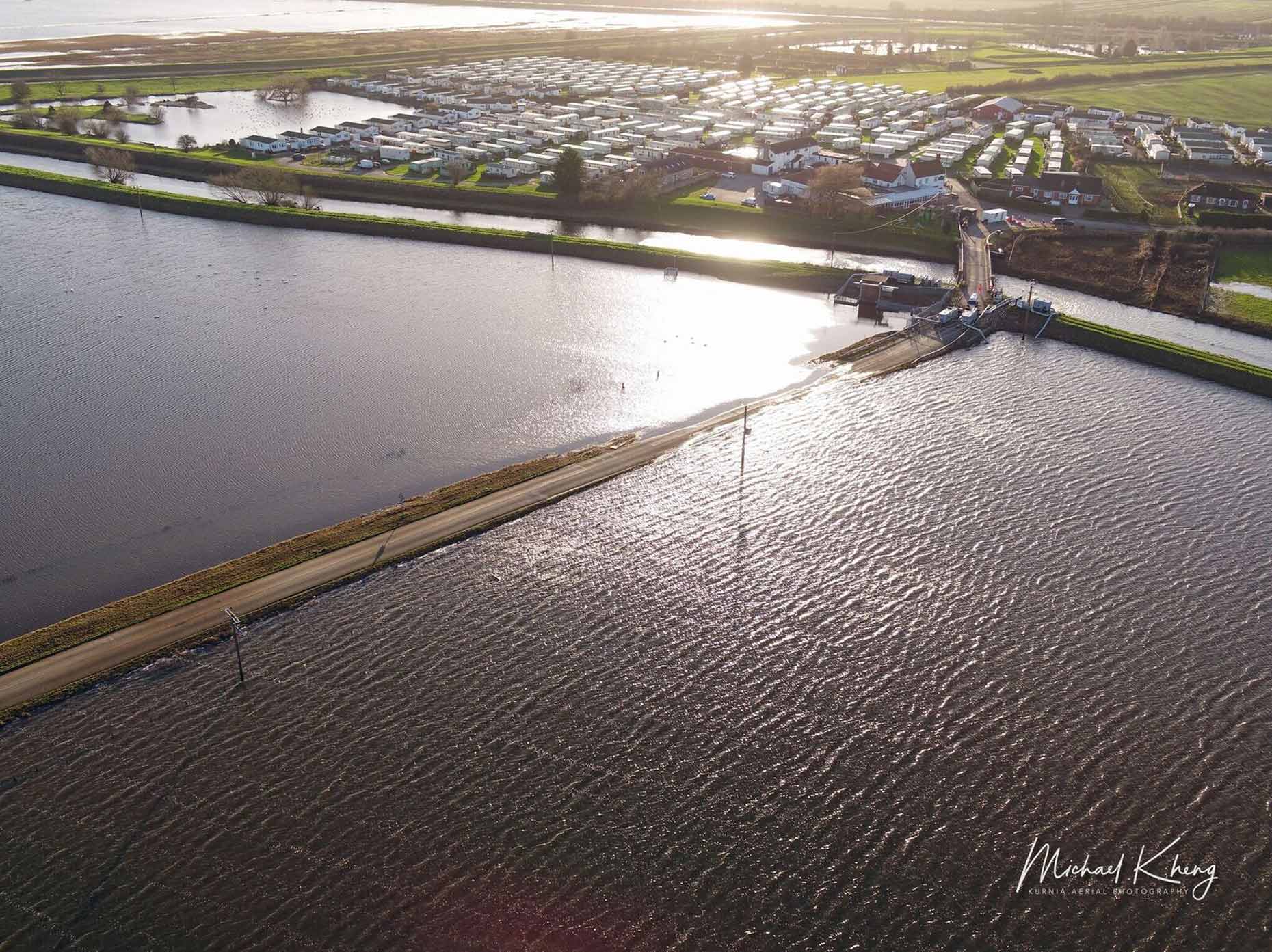
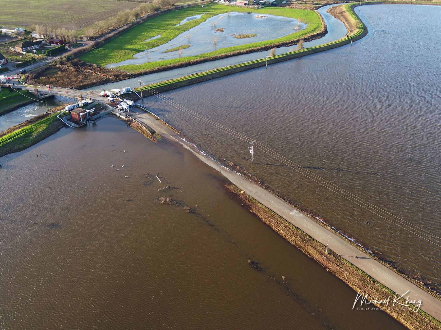
The vast impact of flooding which left farmers stranded near Lincoln is highlighted in the latest photographs of the site nearly two months on from the initial breach.
As previously reported, Lincolnshire County Council’s highways team carried out an initial assessment on the condition of Short Ferry Road on Thursday, January 2, which remains closed at the time of writing.
The Environment Agency completed repair work on the Barlings Eau which involved using a floating pontoon. Pumps also shifted around 48 Olympic-sized swimming pools worth of water off the land every day.
A small section of the road is still flooded and the Environment Agency is continuing to pump water away.
The flood water began to clear just before Christmas and the surface of the road is again becoming visible. Kurnia Aerial Photography visited the site on Friday, January 3 to capture images of the area.
Photo: Kurnia Aerial Photography
Council investigation
The council’s tests used specialist equipment to assess the lower levels of the road, which may have been weakened by the flooding and be liable to collapse under the weight of traffic.
Results of these tests are expected within the next week, but the council warned it may not know the full extent of the damage to the road for some time.
Photo: Kurnia Aerial Photography
Karen Cassar, assistant director for highways at the county council, said: “Although much of the road has now emerged from the flood water, the water levels aren’t subsiding quickly and the pumping will continue into next week.
“There are minor bank slips at the side of the road at various points, and there is a risk of further slips and the edge of the road falling away whilst the soil is saturated. It would be dangerous to allow traffic back onto the road whilst the verges are so soft.
Photo: Kurnia Aerial Photography
“We may not know the full extent of the damage to the road for some time, as the ground dries out in the warmer months. We will continue to monitor the state of the road closely.
“The safety of road users is our number one priority, and we’ll continue to keep residents updated about when we can re-open the road.”
The Lincolnite welcomes your views. All comments are reactively-moderated and must obey the house rules. Please stay on topic and be respectful of other readers.
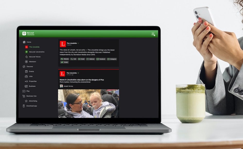
Exciting news for MyLocal app users and The Lincolnite readers! Our latest update is now available to download from your app store and comes packed with the best local news experience you can enjoy.
Revamped News Feed: Enjoy faster loading times and smoother scrolling that make catching up on local news a breeze.
New Play Video Feed: Dive into a dynamic video feed that brings local stories to life in a whole new way.
Enhanced In-App Browser: Access external links quickly and efficiently, right from the app, without any distractions.
Update your MyLocal app from your app store (version 2.73) now and start enjoying these great new features today!
P.S.: Start your MyLocal membership today to support MyLocal and The Lincolnite deliver you a better local news experience and honest journalism from across Lincolnshire.
P.P.S.: We have some huge things in the pipeline, stay tuned!
 Whatsapp