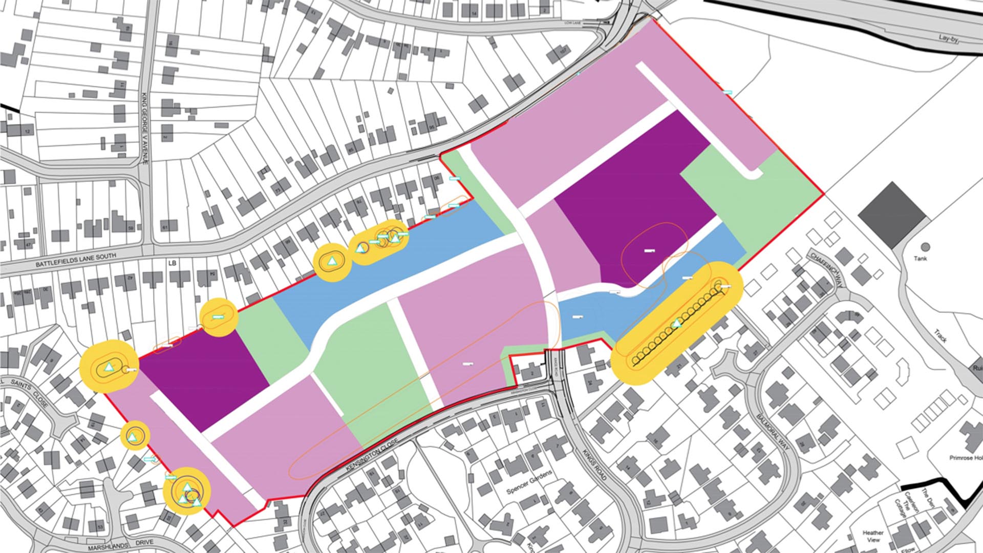
Plans for up to 185 homes in Holbeach are likely to be approved for the second time, despite objections from local councillors and the MP.
The application for land off Battlefields Lane South was first submitted back in 2009, but the permission to start work expired after three years.
Developer Cicero Estates is seeking to renew the application and finally get the project off the ground.
The development would include 139 homes for the market and 46 social or affordable homes, and is recommended to be approved at next week’s planning meeting.
The application says: “Our objective is to positively transform this infill site into a vibrant and thriving place to live that will complement the existing surrounding settlement.”
A report by council officers says there isn’t any good reason to turn the application down.
However, South Holland and the Deepings MP Sir John Hayes has made his objection to the plans known, saying: “I share my constituents’ concerns about the impact this scale of development will have on the local infrastructure, especially as planning permission has already been granted for an additional 900 homes for Holbeach.”
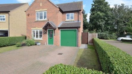
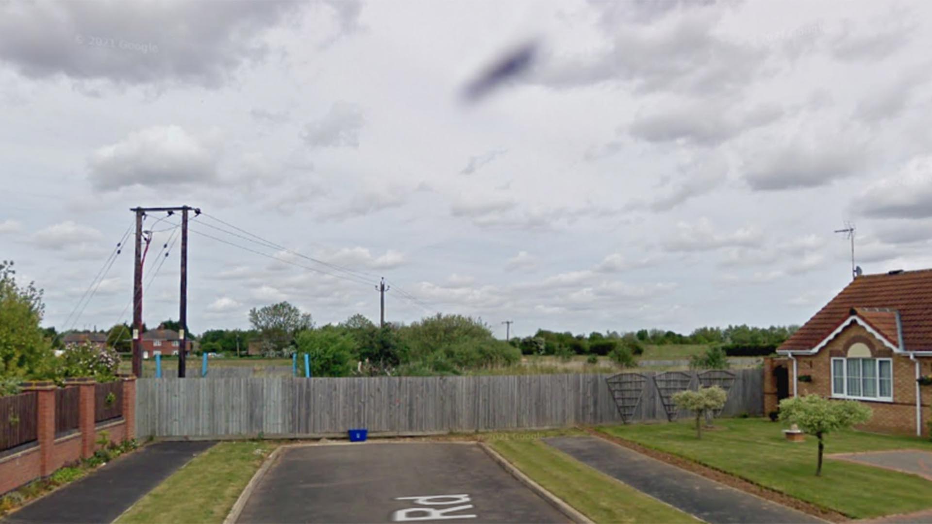
The housing estate would connect Kings Road and Battlefields Lane South. | Photo: Cicero Estates
He added: “Any developer seeking to develop to this extent must be made to make a substantial financial contribution, not only for potential home owners on the site, but also for the existing residents who will be adversely impacted by the proposal.”
An agreement would require the developer to make a contribution of £1.1million for local education, and £120,000 to the NHS.
Councillor Tracey Carter said she also had “serious concerns” about flood risk on the sites.
“We are having considerably heavier rainfall in recent years and a number of areas very close to this proposed site experienced horrendous flooding and disruption recently,” she said.
“This will only be worsened by more fields being used for building, removing the natural drainage they offer.”
The homes would be raised by one metre to mitigate the flood risk.
Council officers had previously warned about the housing estate creating a link between Kings Road and Battlefields Lane South in case it became a “rat run”.
However, it’s now considered this connection would improve the local road network, and would likely be part of the development.
The final decision will be made at South Holland District Council’s planning committee meeting on Wednesday, May 18.
The Lincolnite welcomes your views. All comments are reactively-moderated and must obey the house rules. Please stay on topic and be respectful of other readers.
Exciting news for MyLocal app users and The Lincolnite readers! Our latest update is now available to download from your app store and comes packed with the best local news experience you can enjoy.
Revamped News Feed: Enjoy faster loading times and smoother scrolling that make catching up on local news a breeze.
New Play Video Feed: Dive into a dynamic video feed that brings local stories to life in a whole new way.
Enhanced In-App Browser: Access external links quickly and efficiently, right from the app, without any distractions.
Update your MyLocal app from your app store (version 2.73) now and start enjoying these great new features today!
P.S.: Start your MyLocal membership today to support MyLocal and The Lincolnite deliver you a better local news experience and honest journalism from across Lincolnshire.
P.P.S.: We have some huge things in the pipeline, stay tuned!
 Whatsapp